Showing posts with label National Parks. Show all posts

Thursday, June 11, 2009

Petrified Forest

Wednesday, June 10 - Just a few miles after re-entering Arizona, we made a quick visit to our 7th national park of the trip: Petrified Forest National Park. We got there only a half hour before closing, so we had just enough time to drive the scenic road through the park which takes you through the Painted Desert, past some rock formations called the Teepees, and though the desert strewn with big pieces of logs that have been turned into stone, which date back 225 million years. While our visit was brief, the evening light as the sun was setting cast some really great light on the rocks.

Sunday, June 7, 2009

Cliff Dwellings: Prime Real Estate

Friday, June 5 – Mesa Verde: our 6th National Park in five days. However, this one was a complete change of pace: no more red rock. It’s the only national park dedicated to archeological ruins. The dwellings here date back to 1200 and earlier, but they weren’t discovered until the late 1800’s because they are in such a remote location on the Colorado Plateau. The ruins of the cliff dwellings are pretty amazing – like multi-story condos built of stone in the alcoves in the cliffs.

Say this ten times fast: “Ancestral Puebloan Cliff Dwellings.” Yeah, we couldn’t do it either.

Whenever you enter a national park, they give you some nice handouts. There’s usually a nice colorful map outlining some of the highlights and a newspaper from the park that contains some articles, info on hiking trails, etc. When entering Mesa Verde, they gave us an additional flyer entitled “Rocky Roads Ahead,” since there are a lot of roads alongside cliffs. It contained our most favorite illustration to date – a guy driving a convertible looking over the edge taking pictures while rocks are falling, with some pretty deadpan instructions: “Avoid rocks rolling toward your vehicle,” and “Do not approach fallen rocks.”

In addition to the cliff dwellings, the landscape was pretty beautiful, too. The name Mesa Verde means “green table,” which pretty much gives you a good visual for what the plateau looks like. However, there was a devastating forest fire here in 2000, and much of the park still is scarred with burned trees . We drove out of the park as the sun was setting, and the views were spectacular as we drove down off the mesa back and forth along the side of the cliffs.

Arches National Park

Thursday, June 4 – We made a pretty quick swing though this park, but saw some great highlights. As I believe we mentioned before, Sandy has a thing for rocks with windows and arches, so she was in hog heaven here. Our first stop was to take a look at the Balanced Rock, and then on to the North and South Windows.
The most famous rock formation in the park is the Delicate Arch, which is supposedly the most photographed arch in the world. It is the symbol for Utah, and is the image on Utah license plates. (Incidentally, the motto for Utah is "Utah Rocks!" I wonder who thought of that...) Because it was starting to get dark, we didn't want to drive another 15-20 minutes and then do a hike to go see it, so we chose to view it from a designated viewpoint. Sandy was really excited to see this, since it is the "signature" arch. Anticipation was building as we approached. The reaction when we got there: "Is that it???" It turns out that the arch is only 45 feet high, and from the distance we were viewing from it looked pretty tiny. Oh, well... check that off the list.

The highlight of the visit was the photo below. Note Sandy's pose as she's standing in the "window". The joke was on me, because she was so far away, that I didn't even see her pose as I was taking the picture. (Click on it to enlarge it if you can't see it...)

Saturday, June 6, 2009

Capitol Reef National Park

Thursday, June 4 – While this park wasn’t originally on our itinerary, once we decided to take Route 12 through Torrey, it was inevitable, because the road went right through it. It was a nice added bonus. We started the day with breakfast at the little Capitol Reef Inn and Café, a motel, restaurant and trading post all in one that came highly recommended by two guidebooks. It’s a good thing we read about it, because the breakfast was fantastic, and we would have driven right past it if we hadn’t been looking for it.

Capitol Reef is one of the least known national parks, and has a somewhat confusing name. The name comes from a rock formation which looks like the U.S. Capitol, and a large 100-mile ridge created by the Waterpocket Fold, a big geologic event which pushed the plateau up. When settlers arrived in the area, they thought the ridge looked like a giant ocean reef blocking their way. There are some pretty amazing rock formations here. The big red one below is called the Egyptian Temple.

Smack dab in the middle of the park is the historic settlement of Fruita, where they sell, not surprisingly, some tasty fruit pies. We sampled the Mixed Berry pie as a nice afternoon snack.

Thursday, June 4, 2009

Hiking through Bryce

Wednesday, June 3 - It took us about two hours and forty-five minutes to do the hike through the canyon. After we got through Wall Street, we also saw a rainbow between the clouds above the canyon.

Also, I don’t think I mentioned yet what they call the rock formations in Bryce: “Hoodoos.” Yes, it’s true. After looking at tons of hoodoos, we started seeing things in them – faces, bodies, castles, fists… Random songs also went through our heads, like Simon and Garfunkel... "Who do, who do you think your foolin'?"


Wall Street in Bryce Canyon

Wednesday, June 3 - We took a hike down though the canyon along two trails – The Navajo Loop and the Queens Garden Trail. The Navajo Loop starts with a steep descent into the canyon where you walk down a bunch of switchbacks. Down at the bottom, where the canyon walls are really close together, they call it Wall Street.


There was also an amazing sight down there: a Ponderosa Pine tree that reaches from the canyon floor all the way up to the top to reach the light. Everywhere we turned, there was another amazing view. We took so many pictures that it is difficult to choose just a few to include here. The sky was so blue - it made an amazing contrast to the red rocks.

Good Morning Bryce

Wednesday, June 3 - While we didn't quite make it up to see Bryce Canyon at sunrise, we did make it out for an early morning walk before breakfast. As you can see, it was a little chilly...


We also thought it was really interesting to see how the soft sandstone erodes around the trees along the rim so quickly that it exposes the roots.

Bookmark and Share

The Road to Bryce

Tuesday, June 2 – We finished exploring Zion by the middle of the afternoon, so we headed out to Bryce Canyon. We had to backtrack a bit on that scenic road through Zion, which was great - we could see all of the views in the other direction. There are two tunnels through the rock, one which was built in 1930 and is over 1 mile long. Sandy loves tunnels.

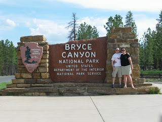
It was only about 85 miles to Bryce, so we were able to get to Bryce before dinner! This was a huge accomplishment, since we normally seem to get to places after 9pm. We were lucky enough to be able to reserve a cabin at the Bryce Canyon Lodge, which was awesome. Another trip back in time. The cabins have been really well restored, so it was very comfortable. Some of our neighbors walked by just as we were moving in, so we asked them to take a picture of us on our porch… Great place! Well, except for the fact that we discovered - as you well know by now – that there was little to no cell phone service in the
park, which meant no checking email, phone calls or blogging… I wasn’t surprised about this,
but it absolutely shocked and horrified Sandy. What are we going to do?? Well, we found an awesome activity…

At 8:30pm we attended an astronomy presentation let by Ranger Don, and then we did some stargazing after class when it got dark. Bryce is one of the darkest places in the country, meaning it has the least light pollution. You can see 7500 stars in the night sky. They had four very powerful telescopes set up outside. These weren’t your ordinary telescopes that you’d have on your back porch. They looked like canons. Two of them were about 24 inches in diameter, and you had to get up on a ladder to look into the eyepiece. My favorite was Saturn. You could clearly see the rings and 3 of its planets. It looked completely fake – like someone had put Saturn stickers on the inside of the telescope. Sandy liked M13 – the most famous globular cluster in the northern hemisphere and about 25,000 light years from earth. It has as many as a million stars in it. We also got an up close look at the surface of the moon and a ring nebula. All in all, a *stellar* evening. Even without connectivity.
Bookmark and Share

Do Not Enter

Dateline: Men’s Room in Zion National Park, June 2, 2009 -


I’ve never seen a road sign in a urinal before, but it certainly gets the message across.


Bookmark and Share

All Aboard the Zion Bus

Tuesday, June 2 – Zion banned cars in the heart of the park beginning back in 2000, so you have to take a bus up the canyon to see it. The bus actually worked out really well, except that on the way back Boy Scout Troup 90 ended up taking over the bus. It was the 2 of us, a German couple, and a bunch of 12-year-old boys and their worn down shaperones. The tweens argued - loudly - for about 20 minutes about which game was the best Wii game of all time. Grrrreat.

They say that Zion is the most “traditional” national park in Utah, which seems to be true. The rock formations are gorgeous, and there are a bunch of hikes for all levels in the canyon. We did two of the easy ones: the first was Riverside walk, which takes you along the Virgin River. Serious hikers actually hike THROUGH the river, where it sometimes gets up to shoulder deep. Maybe next time…


The second was Weeping Rock, where water seeps through the layers of soft sandstone on the top, and then comes seeping out the sides of the cliff when it hits the harder shale underneath. It makes it seem like it is raining from the rocks, and it is like a hanging rain forest.

Bookmark and Share

Breakfast at Zion

Tuesday, June 2 – We headed straight to Zion National Park first thing in the morning. We wanted to eat breakfast in Springdale, a town at the base of the canyon, but had to take a scenic, winding road through part of the park to get there. The views just on the road in were amazing. We then had breakfast at the Spotted Dog Café in Springdale. We sat outside on the patio, and the weather was perfect. Once we got fueled up and made a PB&J for a snack later, we headed back into the park.


Bookmark and Share